From the October 2026 issue of Apollo.
Two years after its £14.5m revamp, the Warburg Institute this month opens the latest in its series of public exhibitions, ‘Night Maps’ (21 October–17 April 2027). Curated in collaboration with the Sunderland Collection, a notable private collection of maps and other cartographic objects from the 13th to the early 19th century, it will focus on celestial maps of all kinds, from our earliest efforts to chart the night sky, filled with gods and monsters, to contemporary data-driven projections. Maps and mapping have been with us, as tools for navigation and spurs to the imagination, for a very long time – mammoth tusk carvings have been dated to 25,000 BC and dot maps of the night sky are found in the caves of Lascaux. They have been fundamental tools in trade, war and exploration and decisive political instruments throughout history. During the Renaissance there was a revival of interest in the cartographic techniques of Ptolemy, sparked by global exploration and the invention of the printing press: his Geography (c. 150 AD, though no copies from before the 13th century exist) was printed for the first time, with engraved maps, in Bologna in 1477. Maps, globes and atlases increasingly became markers of power – of possession, actual and intellectual. Many are also objects of great beauty.
Old maps still have a hold on the imagination. In 2001 the only known copy of Martin Waldseemüller’s Universalis Cosmographia (1507), the first map to name America, was bought for $10m by the Library of Congress. In 2017 the Louvre Abu Dhabi snapped up the Vesconte Maggiolo ‘planisphere’ of 1531 – a two-dimensional representation of the globe – which London-based dealer Daniel Crouch had shown at TEFAF New York that October, priced at $10m. It is a portolan map, designed to help navigation between ports, and notable for showing New York harbour for the first time. It is more than just a tool, however, with its illustrations of mountains, African wild animals and ornate tents painted on goatskin parchment in vibrant colours heightened by lapis lazuli, gold and silver.
Meg Ford, international head of books and manuscripts at Christie’s London, says that there is strong interest at the top of the market both for complete atlases and single sheet maps, with rarity and historical significance the chief criteria of value. Early world maps, from the 15th and 16th centuries, draw strong bidding. In July this year at Christie’s London, an exceptional atlas by Gerard Mercator, Tabulae Geographicae (1585–89), hand-coloured and illuminated in silver and gold with additional engraved maps of Asia, Africa, America and Brazil, which had been in an English private collection since the 19th century, was chased to £1m from a high estimate of £150,000. Ford comments, ‘You are looking for details that mark out the individual copy.’ In this case, the colourists – Georg Mack, David Rem and ‘M M’ – had, very unusually, signed the work. In the same sale a portolan chart of the Mediterranean from 1588, signed by Sicilian chart-maker Jacobo Russo, achieved £165,100 against a £70,000–£90,000 estimate. But the most highly valued sheet maps, Ford says, are of the Americas. She cites the $2.1m paid in 2010 at Christie’s New York – three times the upper estimate – for the first map of post-Revolutionary America created by an American, the Connecticut-born Abel Buell’s A New and Correct Map of the United States of North America Layd Down from the Latest Observations and Best Authorities Agreeable to the Peace of 1783. More recently, in January 2022, a detailed map of New York by British soldier and cartographer Bernard Ratzer, dated January 1776, sold at Christie’s New York for $625,000 against an estimate of $300,000–$500,000.
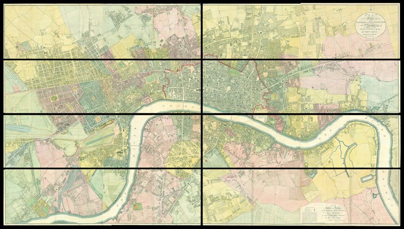
Daniel Crouch says that there are fewer collectors at the top end than there were, but interest is found across price levels. As he points out, ‘Your satnav has much more in common with 17th-century maps, aligned in the direction of travel, than with OS maps.’ Collectors tend to prefer maps from their own region, but Crouch is clear that ‘the single most important criterion of value is the story the map tells.’ At this year’s Frieze Masters he will display Richard Horwood’s map of London from 1799, printed on 32 sheets – at the time, the largest map ever printed in Britain (£40,000). Produced for the Phoenix Fire Company, it was the first attempt to create a map of London with all of the houses delineated and numbered.
Luca De Martini, of Altea Gallery in Mayfair, also notes the local interest in London maps. The gallery exhibits at Lapada Fair in October and has available a first-state printing of the earliest surviving town plan of London, engraved in 1572 by Frans Hogenberg and published in Cologne (£15,000). This uncorrected version is included only in the first edition of the famous Civitates orbis terrarum (1572), the first printed atlas of the world’s cities, produced by Hogenberg and his partner Georg Braun. De Martini says that other areas of strong interest globally are North America, the Middle East, Singapore and India. ‘There is a very big demand for British Indian maps and precolonial maps – this is a growing market. Institutions are also interested in the mapping of India.’ He is currently putting together a collection of maps detailing the history of Singapore in the Second World War – maps dated just before or after a momentous episode in history are always sought after. De Martini also has available a fine hand-coloured, wood-cut Ptolemaic map of the Arabian peninsula, reworked by the cartographer Nicolaus Germanus, cut by Johannes of Armsheim and published in Ulm by Lienhart Holle in 1482 (price on application). The cost of the crushed lapis lazuli from Afghanistan, used for the deep blue sea, bankrupted Holle.
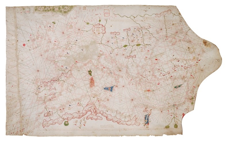
The London-based rare book dealer Peter Harrington takes a strong interest in atlases because, as specialist Emma Walshe says, ‘We find it interesting when these navigational tools get bound up together, putting a whole vision of the world into people’s hands.’ They have available a first edition of the Ptolemy Geography with new maps by Waldseemüller, the first modern atlas (1513), in a contemporary pigskin binding, in good condition, for £750,000. ‘It was not until the 18th century that atlases were identified as collectable – and then usually rebound. An original binding is very rare.’ Occasionally the dealership handles individual maps, such as the extremely early Rex Thomoleus portolan chart (1365–85), one of the earliest complete maps of Europe, hand-painted on stretched vellum (£3.8m), on view currently. It is the fourth-oldest map of its kind in existence, the other three being in public institutions.
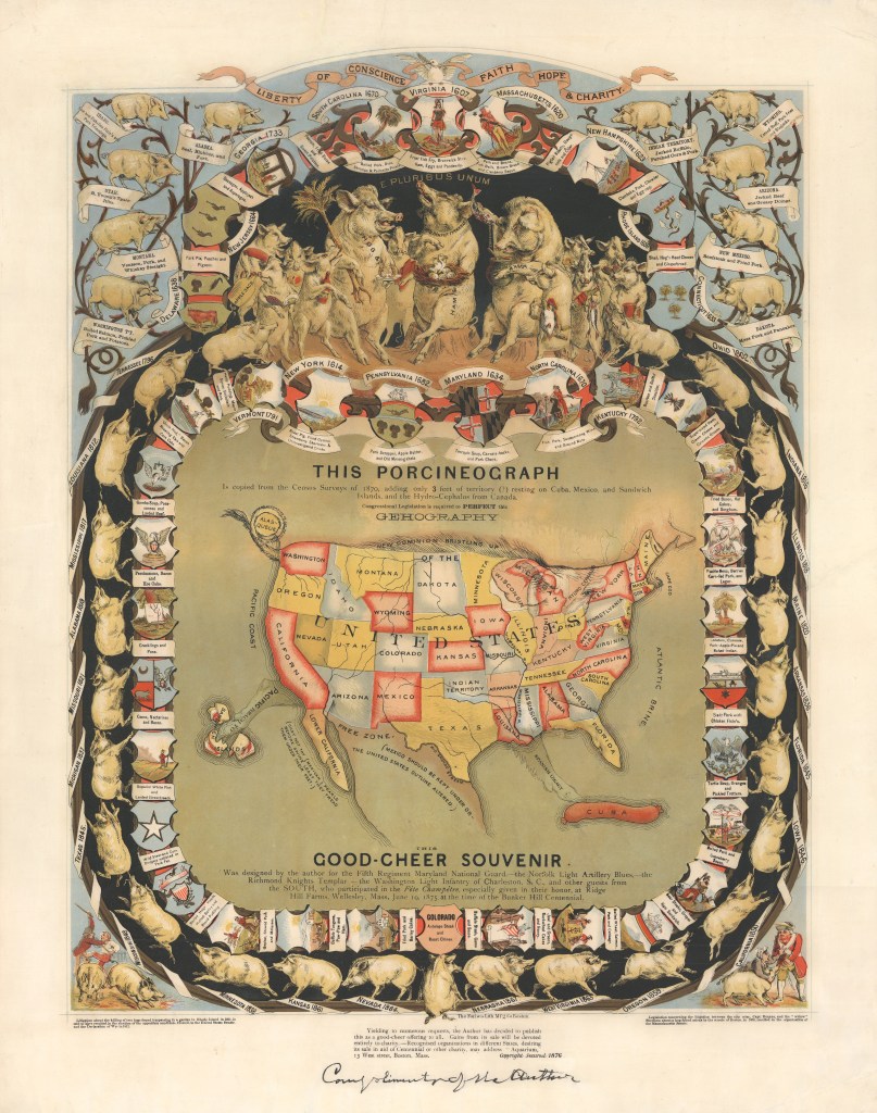
Kevin James Brown of New York dealership Geographicus Rare Antique Maps says that the market was transformed by the internet. ‘In the past, every town in Europe had an antiquarian bookstore selling local antiquarian maps.’ Pricing was haphazard. With the arrival of the internet, the market was flooded with, for instance, 17th-century European maps by the Dutch mapmaker Willem Blaeu. The dealerships that survived had access to scholarship and focused on the rare and historically important. Today, collectors pursue the best examples of well-known early maps. A strong interest in rare historic maps of China and Russia peaked in 2020 and has now waned. Most energy, however, Brown thinks, is in 20th-century material: ‘Institutions are looking for substance. Maps that show something historically significant.’ He cites a Russian map showing Stalin’s plan to flatten Ukraine, or maps of the Arab emirates after independence. He has available a rare large and detailed map of Qing China, by Dong Fangli and Li Zhaoluo, from 1832 ($65,000) and the first scientific survey of the Islamic holy city of Medina, in modern-day Saudi Arabia, from 1880 ($85,000).
From the October 2026 issue of Apollo.